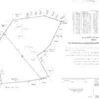
Paneng settlement
- Title
- Paneng settlement
- Alternative Title
- Ntsawamahatshe
- Location Type
- farm
- Farm Number
- 548
- Nearby Town
- Gathlose
- District Municipality
- John Taolo Gaetsewe
- sourced from https://www.geonames.org/maps/google_-27.8746_23.2341.html
- Local Municipality
- Ga-Segonyana
- sourced from https://www.geonames.org/maps/google_-27.8746_23.2341.html
- Magistrate District
- Kuruman
- Province
- Northern Cape
- Description
- North-East of Postmasburg
- History
- Paneng is a village in the baTlharo reserve at Maremane. The Tswana in Maremane Reserve belong to the baTlharo tribe, who live in a large area west and south-west of Kuruman. The present Maremane Reserve was an outpost grazing area around 1850, when the baTlharo were ruled by chief Makgolokwe and his son, Toto, who was then living in the Langberg. Andries Waterboer, the Griqua chief at Griquatown, permitted them to reside in his country; the headman was then Isaak Thupane. He was also granted the area of Logageng, also called Gatkoppies or Blinkklip (PL Breutz, The Tribes of the Districts of Kuruman and Postmasburg, 1963, p. 107)
- Latitude
- -27.8746
- Longitude
- 23.2341
- Geographic coordinates sourced from
- Chief Surveyor General Geographic Information System
Linked resources
Part of Paneng settlement