Koopmansfontein farm
- Title
- Koopmansfontein farm
- Location Type
- farm
- Farm Number
- 212
- Nearby Town
- Barkly West
- District Municipality
- Frances Baard
- sourced from https://www.geonames.org/988035/koopmansfontein.html
- Magistrate District
- Barkly West
- Province
- Northern Cape
- Description
- West of Barkly West
- Toponomy
- Named after the Griqua Koopman family
- History
- Since the 1820s, Koopmansfontein was under Griqua control. In the 1870s, the Griqua Kapteyn Niklaas Waterboer claimed ownership (PHR Snyman, Danielskuil: Van Griekwa-buitepos tot dienssentrum, HSRC, 1988, p.25), although this was rejected by the new Colonial government. Instead, the farm was allocated to Robert Stewart (Snyman 1988, p. 28). Koopmansfontein was an important farm in the vicinity. In 1895, a school for 46 white children was established, although it lasted only two years due to grinding poverty in the region (Snyman 1988, p. 49). The farm was a political hub of the Afrikanerbond, under the leadership of FJ Strauss. The Bond opposed the British expansionist policies of Cecil John Rhodes. In 1894, a postal agency was established at Koopmansfontein. in 1937, an agricultural research station was located at Koopmansfontein, and regular livestock auctions were held (Snyman 1988, p. 74).
- Latitude
- -28.2623
- Longitude
- 24.0545
- Geographic coordinates sourced from
- Chief Surveyor General Geographic Information System
Linked resources
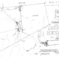
Part of Koopmansfontein farm