
Khuis farm
- Title
- Khuis farm
- Location Type
- farm
- Farm Number
- 181
- District Municipality
- John Taolo Gaetsewe
- Local Municipality
- Joe Morolong
- Magistrate District
- Gordonia
- Province
- Northern Cape
- Description
- Khuis Location is in the far north-western corner of the Kuruman district on the Molopo River, which is the boundary with Botswana
- History
- The country is stony (white limestone), and studded with thornbush and meagre desert vegetation (PL Breutz, The Tribes of the Districts of Kuruman and Postmasburg, 1963, p. 111). Between 1820 and 1830, the baTlharo chief Morwe came to Khuis to escape the superiority of the Tlhaping chief Mothibi. After the Tswana rebellion in the Langberg in 1897, the majority of baTlharo came to Khuis. A significant number of the community still lives on the northern side of the river (i.e. in neighbouring Botswana). The baTlharo at Khuis interacted with the Kattea tribe, an ancient group of hunter-gatherers, related neither to the Khoisan nor the baTswana (Breutz, p. 25). Some of the Kattea became serfs of the baTlharo, and also intermarried with them (Breutz p. 112).
- Latitude
- -26.71176
- Longitude
- 21.86549
- Geographic coordinates sourced from
- Mapcarta
Linked resources
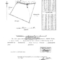
Part of Khuis farm